More hiking
Yep, we are predictable. The locals raved about the hiking opportunities in Lincoln National Forest and they were right. We could have hiked a different trail for many days.
We made the trip from Alamogordo's 4000 ft elevation into the Sacramento Mountains and the town of Cloudcroft at 8700 feet. We noticed a line in front of Mad Jack's BBQ and had to check out their chopped brisket with green chile, taking half home for dinner. There was a steady flow of airmen from the base in Alamogordo picking up their BBQ orders to take back to the base.
Fortunately, the roads were well marked. I'm not sure we would have found the Grandview and
Bridal Veil Falls Trailheads. The Rails-to-Trails rolls down a 3% grade to a seasonal waterfall.
Bridal Veil Falls Trailheads. The Rails-to-Trails rolls down a 3% grade to a seasonal waterfall.
Grandview Trail Overlook
The Mexican Canyon Trestle Trail is near Cloudcroft. The trestle was built in 1899 and the only one left of the 57 trestles taking people from Alamogordo and El Paso into the mountains when the valley heated up.
Breakfast in Tularosa, NM felt like we were south of the border, menudo for Sunday breakfast and lots of Spanish speaking going on.
Oliver Lee State Park is set against the Sacramento Mountains a few miles from Alamogordo with a beautiful campground in the Chihuahuan Desert. Can't beat $14/night for hookups.
Before arriving at Oliver Lee State Park, we had agreed to keep our hike easy since we had hiked the 3 previous days. It was so pretty but only had two options. The short Riparian Trail which would take 15 minutes or Dog Canyon Trail.
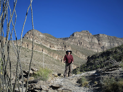
We gave the challenging Dog Canyon Trail a shot since we were there. (How difficult could it be?) We soon found out. Knowing that we could turn around when we had had enough, we started up. Of course, there is always the wonder of what is around the next corner that keeps us going. I was glad we had our poles for the downhill.
The distant views include White Sands, the Tularosa basin, and the Organ and San Andreas mountains.
Three miles in is the remnants of a cabin built by a rancher many years ago. An elevation gain to the cabin 1834ft gave our hearts a reason to pound. I passed on the next 2.5 miles which is straight up with a long drop on the side and a long walk back.
Someone was thinking when they built this spot.
"Frenchy" Roccas, a French emigrant, lived alone at Dog Canyon in 1889 where he tended his cattle, grew a vineyard and orchard before he was found with a gunshot to his chest. What a view!
After our hike, while sitting a restaurant a couple struck up a fun conversation. By the time we left, we had an invitation and directions to their house. We love the people we meet along the way.


