Down Some Red Dirt Roads
We found our selves in the middle of the annual southward migration of the grey haired Snowbirds as we arrived at the KOA north of Salt Lake City on our way to Central Utah. There doesn't seem to be any danger of extinction any time soon. Mike built a fire in the community fire ring which signaled to the birds to come out of their mobile nests for some sharing before settling in for the night.

We woke to a temperature of 15 degrees in Torrey, Utah outside of Capitol Reef National Park. Fortunately, nothing in the trailer froze and we were snug and warm until someone (Mike) had to get up in the morning and turn up the heat. The campground water tap was frozen. But our pipes were fine.
The dry camping campground nestled in the Fruita section along the Fremont River in the national park was booked up which was fine with me since it was so cold and our little heater could run all night. Sand Creek Campground in Torrey was only 5 miles from the national park.
Our last visit to Capitol Reef National Park was 10 years ago. It doesn't matter how many times we visit the red rocks of southern Utah and Arizona, we always are glad to be back.

Located in south-central Utah in the heart of red rock country, Capitol Reef National Park is a hidden treasure filled with cliffs, canyons, domes, and bridges in the Waterpocket Fold (a wrinkle on the earth) extending almost 100 miles.

The most scenic portion of the Waterpocket Fold is known as Capitol Reef: capitol for the white domes of Navajo Sandstone that resemble capitol building domes and reef for the rocky cliffs which are a barrier to travel, like a coral reef.

It was a chilly 40 degrees as we started hiking each morning. It didn't take long, once we started climbing in the sunshine to start shedding layers.

 |
| The Castle |
A nearly 100-mile long warp in the Earth's crust, the Waterpocket Fold is a "step-up" in the rock layers. Movement along the fault caused the west side to shift upwards. I bet there were some big earthquakes when the land shifted upward.

The area of Capitol Reef has been a homeland to people for thousands of years. Archaic hunters and gatherers migrated through the canyons, to farmers of corn, beans and squash. Petroglyphs etched in rock walls and painted pictographs remain as sacred remnants of the ancient saga.
Latter-Day-Saint (Mormon) pioneers, and others arrived in the 1800s, planted orchards of apples, pears and peaches.
Latter-Day-Saint (Mormon) pioneers, and others arrived in the 1800s, planted orchards of apples, pears and peaches.

The hike to Hickman Bridge was a short 2 mile round trip but adding the Rim Trail made it just right.


It seemed that some "city slickers" were herding these cows, backing up traffic for quite a while as they wandered back and forth across the highway as we were heading to Hanksville, Utah.


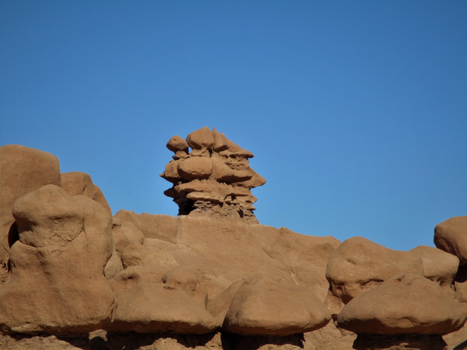
Goblin Valley State Park
Cowboys searching for cattle first discovered secluded Goblin Valley. They came to a vantage point about a mile west of Goblin Valley and were awed by what they saw, five buttes and a valley of strange-shaped rock formations surrounded by a wall of eroded cliffs.
In 1949, Chaffin returned to the area he called Mushroom Valley. He spent several days exploring the mysterious valley and photographing its scores of intricately eroded creatures. He kept the place a secret until the area was acquired by the state of Utah and officially designated a state park.

We made Duke's Campground in Hanksville our basecamp while visiting the small 3 square mile Goblin Valley State Park between Green River and Hanksville, Utah. It turned out to be a good plan to drive the 28 miles back rather than take our trailer and hope for a parking space on our way to Green River. The lot was small and filled up quickly.
The small state park campground was full. The yurts were pretty cool nestled in the rocks. There is a lot of BLM dry camping options outside of the park along the San Rafael Swell. We wouldn't mind spending more time and exploring the area more.

The Valley of Goblins has three established trails, which lead to overlooks and deep within the maze of sandstone formations. We took the Goblin's Lair Trail first. But the best thing was that we were allowed to hike freely off trail, to explore the hoodoos, mushrooms, or goblins on our own.


This strange and colorful landscape is filled with bizarre sandstone rock formations called goblins. Visitors can wander off-trail to explore the geology and hike among the nooks and gnomes.


The three sisters
The next day it was smooth sailing to Fruita, Colorado.


