Tuesday, November 26, 2019

Hueco Tanks State Historical Site, Texas

Climbing in the Rocks

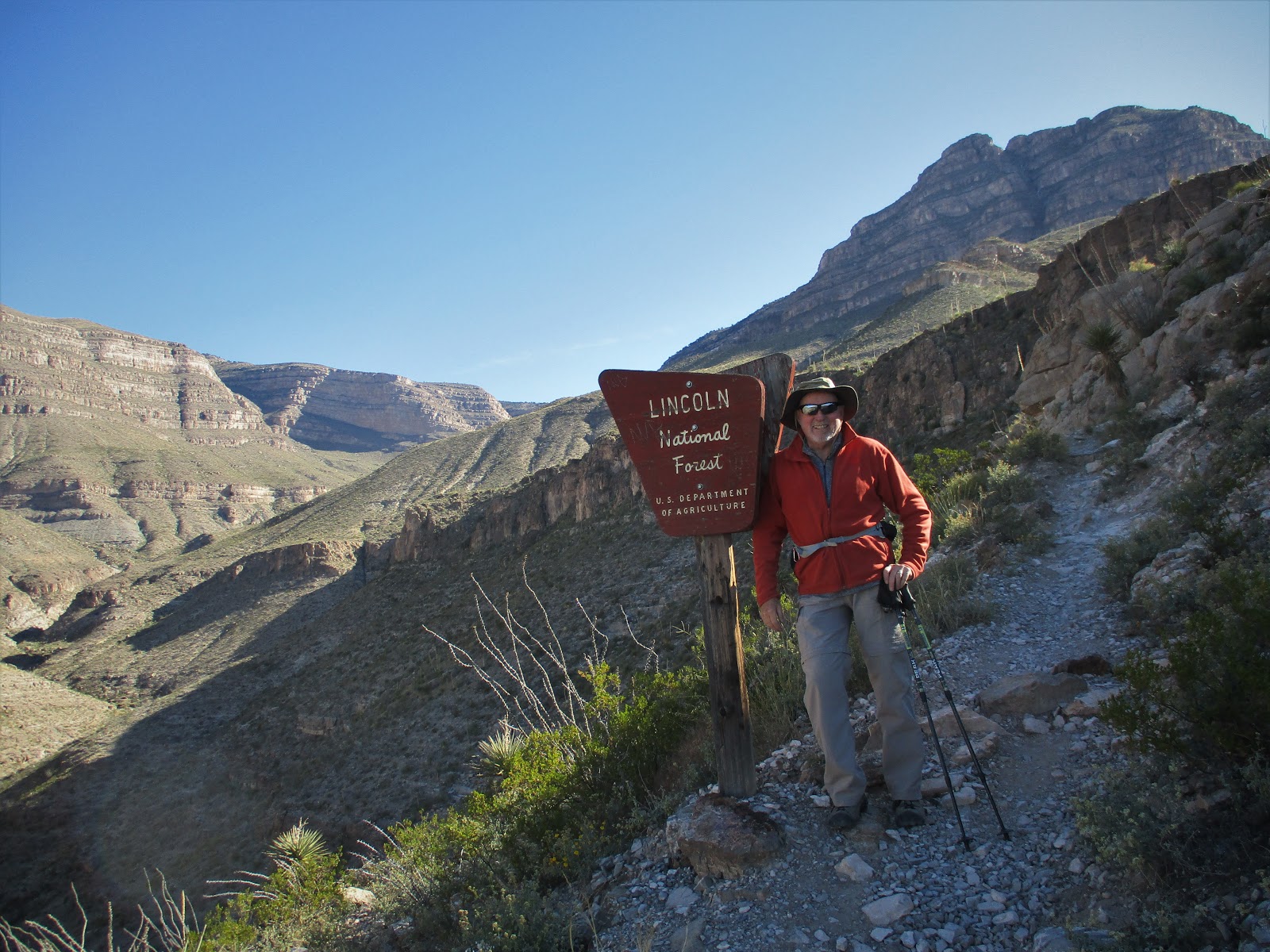
As we crossed into El Paso Texas, the mileage sign read 892 miles to Beaumont TX. That's a long ways across Texas. If we are going to drive through the state we might as well "see" it. Even if we are only going half way this time.
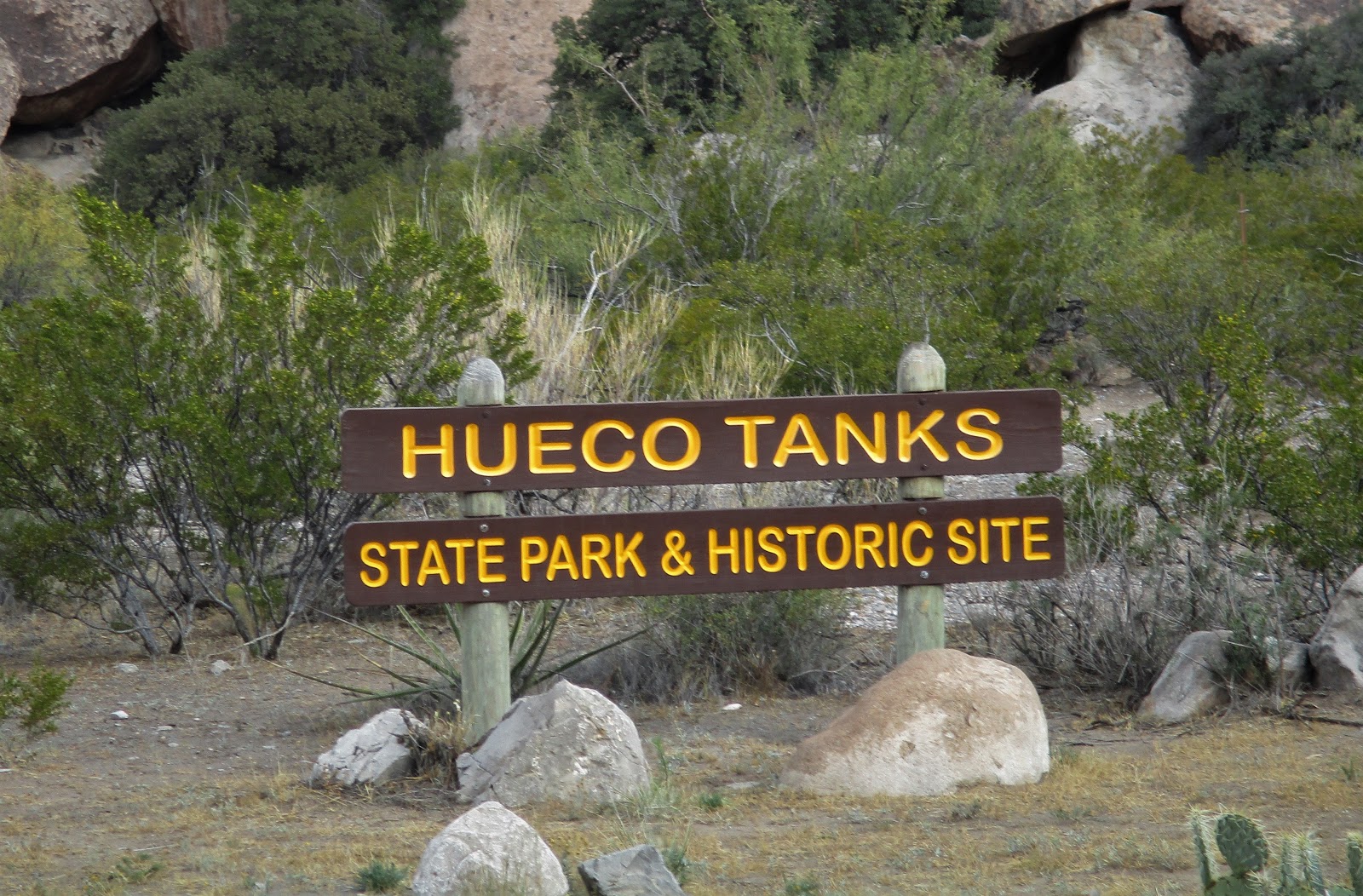
We learned about Hueco (whey-coe) Tanks State Historic Site 30 miles north of El Paso from Raven and Chickadee's blog. It has one of the largest groups of Native American rock paintings and masks in North America
As we were driving to the park, Mike asked "where in the heck are we going?" I was thinking the same thing. Until we reached the rocks, things were looking a little shaky.
We watched the required 15 minute video in the visitors center reminding people to be good stewards of the place and help preserve the area before hitting the trails.
We made reservations for the 20 site campground but only six sites taken during our stay. It gets very dark at night as the stars filled up the sky.

We planned ahead reserving a self guided permit for the day that we arrived since only 70 people can enter North Mountain at a time due to the fragile nature of the park.
As far back as 1,500 years ago, Hueco Tanks visitors left pictographs and petroglyphs around the area. This was a stop for the Butterfield mail stagecoach. Many of the people passing through left their signatures on the walls in the 1800s often over those from ancient times.
I was glad Mike had his hand on the chain as we climbed back down. His foot hit a section on rock that had broken away. He would have taken a bad fall if he had not been hanging on.

I also booked the guided tour in the guide only East and West Mountains several weeks in advance for the only slots left open for our weekend there. It would have been a shame to miss that.
Masks in the top of a cave.


Our guide was 78 years old. I wasn't sure what kind of tour this would be. At first he was walking slow and a bit unsteady. By the end of the tour, he had us climbing and navigating rock walls. OK, I know my thinking was "ageist". He is a retired history teacher and very good at spinning his tales. He said the some of the best pictographs were on North Mountain that could be accessed without a guide.

We climbed along the ledges above the valley for a stop in a cave for more stories from our guide.


People come from all over the world to boulder (rock climbing) with only their hands and a crash pad to catch them when they fall.

To get directions, we had to give the ranger our driver's license then he gave us a sort of map of directions to get to Cave Kiva. It took some rock scrambling to find it just off the trail we had been on a couple of days before. It helped that a couple were on the way back down from the cave as we were going up. Mike did his usual critter check before we headed in. It is one of his jobs, checking restrooms or other places critters could hide before I enter. He has only had one run in with a critter so far. He put his hand where he shouldn't have and a crab was on his finger when he removed it. But that's another story.

I hadn't charged my camera's battery in a while. Once we found Cave Kiva, it gave me a rude charge battery message and shut down. Actually, I was glad it happened as a reminder for me to take the charger along on a trip to Mexico we have planned later this winter. I believe I would have forgotten to pack it.

Several storms were brewing in the Pacific Ocean as we headed towards Fort Stockton, TX. We were parked between two large rigs that might have helped cut down on the wind and
gusts 55mph for two days. It gave us a chance to rest up, do laundry and stock up the fridge as we were winding down our two months traveling from Oregon to Texas Hill Country.


Friday, November 22, 2019

Las Cruces, New Mexico

Scoundrels in the Borderland

As we walked in Las Cruce's Walmart, a police officer was posted at the front door and another strolling through the isles. I got an uncomfortable feeling remembering the El Paso Walmart 45 miles away that just reopened after the recent shooting. The greeter at the front door said he was glad the police were there.
Overlooking Las Cruces are the Organ Mountains, named because of the steep, needle-like spires that resemble the pipes of an organ. This area of rocky peaks, narrow canyons and open woodlands shelters the Dripping Springs Natural Area, noted for its "weeping walls"overlooks the Rio Grande and the Mesilla Valley.
I asked the volunteer at the visitor center about the snake situation before our hike. She said that the few that they have seen were pretty docile. Except the 4 foot rattlesnake (scoundrel) that welcomed her to work the previous day and wasn't leaving his post without help from the rangers. Aghhh! Fortunately, we avoided any interactions with snakes.

The Dripping Springs Natural Area has over four miles of  hiking trails, including the Dripping Springs Trail which gradually climbs into the cooler box canyon.

It is a steady incline for the majority of the “out” portion of the trail but there are shade trees and even some benches along the way. 

In the 1870s, Colonel Eugene Van Patten built his Van Patten’s Mountain Camp resort. People would arrive by horse and stagecoach.
The scoundrel Doctor Nathan Boyd established a tuberculosis sanatorium on this property with a promise to pay $25 per year which he never paid even after Van Patten took him to court.
On our return we turned onto the Crawford Trail without shade on that trail even though the temp was 60 degrees, the sun felt hot. 
The Mesilla Valley

La Mesilla "Little Tableland"

 Apaches and other tribes regularly camped in Mesilla. After the treaty of Guadalupe Hidalgo in 1848 that the first permanent settlers came to Mesilla to call it their home. 
In 1854, The Gadsden Purchase declared Mesilla officially part of the United States and became an important stop on two stagecoach routes, the El Camino Real and the Butterfield stage route.

Mesilla was as wild as the West gets, with outlaws frequenting many of the bars and dancehalls. 
In 1881, Billy the Kid was tried and sentenced to hang at the jail and courthouse on the southeast corner of the plaza. The Gadsden Museum has the original jail cell doors that held Billy the Kid.
Mesilla's Plaza is similar to that in Santa Fe but much smaller.
After a morning walk through Mesilla's countryside of pecan trees and ugly fruit, we had brunch at "Josephine's". The green chile in my quiche was the best. We are in New Mexico after all.


While in Las Cruces, Mike's 1 year old Samsung phone's google play popups kept blocking his phone. After trying online suggestions, he took it to the Verizon store. The rep turned the phone off and on before handing it back to him saying he needed a new phone. She was pushing the "best" phone for a total of $900.  Another scoundrel. He passed and called tech support since he had insurance on it. They weren't able to resolve the issue but sent him another phone at no charge and free shipping to return the problem phone.
Rain was again in the forecast and walking in town isn't so pleasant. We headed out to Mesilla Valley Bosque State Park nearby.


The bosque (forest)
Texas is just around the corner.

Tuesday, November 19, 2019

Lincoln National Forest

More hiking

Yep, we are predictable. The locals raved about the hiking opportunities in Lincoln National Forest and they were right. We could have hiked a different trail for many days. 

We made the trip from Alamogordo's 4000 ft elevation into the Sacramento Mountains and the town of Cloudcroft at 8700 feet. We noticed a line in front of Mad Jack's BBQ and had to check out their chopped brisket with green chile, taking half home for dinner. There was a steady flow of airmen from the base in Alamogordo picking up their BBQ orders to take back to the base. 
  Fortunately, the roads were well marked. I'm not sure we would have found the Grandview and
Bridal Veil Falls Trailheads. The Rails-to-Trails rolls down a 3% grade to a seasonal waterfall.
Grandview Trail Overlook
The Mexican Canyon Trestle Trail is near Cloudcroft. The trestle was built in 1899 and the only one left of the 57 trestles taking people from Alamogordo and El Paso into the mountains when the valley heated up.


Breakfast in Tularosa, NM felt like we were south of the border, menudo for Sunday breakfast and lots of Spanish speaking going on.

Oliver Lee State Park is set against the Sacramento Mountains a few miles from Alamogordo with a beautiful campground in the Chihuahuan Desert. Can't beat $14/night for hookups.
Before arriving at Oliver Lee State Park, we had agreed to keep our hike easy since we had hiked the 3 previous days. It was so pretty but only had two options. The short Riparian Trail which would take 15 minutes or Dog Canyon Trail.
We gave the challenging Dog Canyon Trail a shot since we were there. (How difficult could it be?) We soon found out. Knowing that we could turn around when we had had enough, we started up. Of course, there is always the wonder of what is around the next corner that keeps us going. I was glad we had our poles for the downhill.  


The distant views include White Sands, the Tularosa basin, and the Organ and San Andreas mountains.
Three miles in is the remnants of a cabin built by a rancher many years ago. An elevation gain to the cabin 1834ft gave our hearts a reason to pound. I passed on the next 2.5 miles which is straight up with a long drop on the side and a long walk back.
Someone was thinking when they built this spot.


"Frenchy" Roccas, a French emigrant, lived alone at Dog Canyon in 1889 where he tended his cattle, grew a vineyard and orchard before he was  found with a gunshot to his chest.  What a view!

After our hike, while sitting a restaurant a couple struck up a fun conversation. By the time we left, we had an invitation and directions to their house. We love the people we meet along the way.

Cuenca, Ecuador

An Expat Destination The morning after returning to Quito we boarded an hour-long flight to Cuenca. Driving up the winding roads would have ...