MONDAY, APRIL 13, 2015
Sedona, AZ and Red Rock State Park
We have always enjoyed going to Sedona and hiking in Red Rocks State Park, but Sedona is getting pretty crowded. Maybe spring time brings out the people. There has been lots of building going on there. We have always enjoyed the village of Oak Creek. There is a $5 parking fee to use the trails.
We hiked along the Yavapai Trail across the road from Bell Rock and was much less crowded once we reached the Hiline Trail. The views were wonderful with shade from the bushes. You can hike for many miles. There were a few mountain bikes along the way. The view of cathedral Rock was peaceful with a light breeze in the air. At this point we sat a while enjoying the sunshine before starting back.
We have not experienced the Vortex but just enjoy the sunshine and red rocks.
Posted by Treking with the "B"s at 2:17 PM No comments:
SATURDAY, APRIL 11, 2015
Tour of Glen Canyon Dam

The tour of Glen Canyon Dam was well worth the $5 and time. Page became a town when a site for the dam was designated. Above are dinosaur footprint.

The view from the dam and watching the rafts leave going towards Lee's Ferry.

We decided to try out our new inflatable kayak. We had tried it out at home but didn't go quite as well under the warm sun. Lake Powell is a huge lake and fortunately the winds were
After getting the kinks out, we had a nice tour around the marina.
Posted by Treking with the "B"s at 4:13 PM No comments:
Dead Horse Ranch State Park, AZ
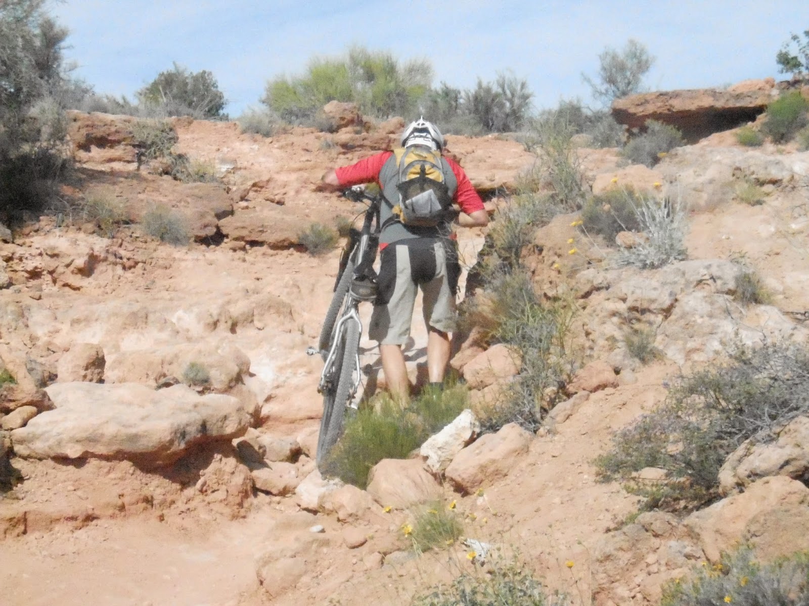
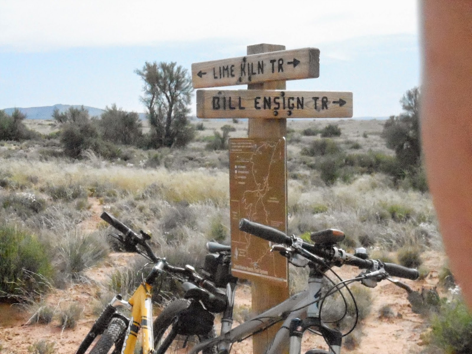
Good thing every bike comes with a hiker. We spent time in Dead Horse Ranch State Park and found Some great mountain biking right outside our doors. Some Of it a bit over my head but I can push it over obstacles.

The Lime Kiln Trail goes to Sedona, AZ without much traffic. The next day we went over to the Bones Trail and Mike ended up leaving some skin on the trail. Good thing his bones are tough. His left hip is pretty bruised. But it was a good time.

The campground has 3 nice fishing areas that people were putting out their canoes. The Verde River runs along side the park and many people ride tubes down it when it is running a bit higher than when we were there.
Dead Horse Ranch was named that because when the owner was looking at areas to put a ranch the kids said they liked the land with the dead horse on it.
Posted by Treking with the "B"s at 4:12 PM No comments:
SATURDAY, APRIL 4, 2015
We made it to Page AZ after driving thru some tough winds and cool mornings.

It was short hike to the edge overlooking Horseshoe Bend. We enjoyed watching the boats and campers below. Met several nice Canadians from BC returning home after their winter in Arizona.

We decided to take the Antelope Canyon Tour lead by Navajos and enjoyed the walk and talk. The guide was helpful adjusting our cameras to get the best photos. The only tour available was the 3:30 and thought we wouldn't get as good pictures since the light would have passed. We were glad we went.

There are only a couple of campgrounds in Page and were happy with the Page Lake Powell Campground and glad we had reservations. Many people were turned away and ended up staying in the Walmart parking lot. It is quite a distance to the next town or RV park. Most of the land is Navajo so not a lot of dry camping.

The tour company picked us up at the RV park and returned us. It was a breezy ride but fun.

Posted by Treking with the "B"s at 3:08 PM No comments:
WEDNESDAY, APRIL 1, 2015
Moab, UT
It had been quite sometime since we had last been to Moab and were pleased to find the paved bike paths leading out of town past Arches National Park and east towards Castle Valley. There are also so much singletrack near town for mountain biking of all levels. We are torn whether to ride our road bikes or mountain bikes.

There are so many choices when it comes to hiking . We found that there are so many choices outside the parks. You don't have to hunt for parking and there are plenty of arches and streams to walk along. We chose an afternoon hike to Morning Glory Natural Bridge since there is more shade but still had to dunk our hats in the stream to cool us down.

We will have to return since we couldn't do everything we wanted. This week is Jeep week and hundreds of 4x4s line up in the morning to head out on a "safari". Camping sites are very limited the week of Easter.
We have seen many of southern Utah's Parks but missed the Canyonlands in the past. This time we made it and had some nice walks.
We set out for Page, AZ in the morning so after our morning bike ride we are doing the laundry and getting some groceries. Since it is April 1st, I had to play an "April Fools" joke on Mike. After all of this time together, you think he would expect it. He takes them pretty well.
Posted by Treking with the "B"s at 12:09 PM No comments:
TUESDAY, MARCH 31, 2015
Mountain biking in Fruita Colorado
We have loved mountain biking and hiking. So we packed up the RV and headed to Fruita near Grand Junction for some spring riding. It is usually best in the spring or fall since it has desert like temps in the summer.
We camped at John Robb State Park outside of Colorado Monument, a must see if you are here. A great campground with full hookups and laundry. We were having record temps and glad to be able to use the air conditioning. There were a few Harvest Hosts in the area that we want to try out but John Robb was great with lots of room.
Some of the trail got a bit over my head but every bike comes with a hiker.
Love this trail but will be leaving for Moab in the morning.
Posted by Treking with the "B"s at 5:13 PM No comments:
Home
Subscribe to: Posts (Atom)
Followers


 We like to stop at Coyotes at the Greenway Nature Center but it turned out the be closed. After a Cliff Bar, we rode back to downtown to find some food. We get into a habit when we find a good place to eat. This made us venture out and find a place in the Union District.
 <
a href="https://blogger.googleusercontent.com/img/b/R29vZ2xl/AVvXsEiIBbGMO8rXlf3aFzxsMU-9QAXdzGHRVyzrx9rIbfqZSqQfXJWPElAVYMZF7WY2v6QxQVpyLwhyphenhyphen8NC0nc3O_RQefYtSin_oXKoYksMdcPxIGdDWnZBc7-Ht_dLM3-d7LSfpoLylSszbjO4/s1600/pueblo.jpg" imageanchor="1" >
<
a href="https://blogger.googleusercontent.com/img/b/R29vZ2xl/AVvXsEiIBbGMO8rXlf3aFzxsMU-9QAXdzGHRVyzrx9rIbfqZSqQfXJWPElAVYMZF7WY2v6QxQVpyLwhyphenhyphen8NC0nc3O_RQefYtSin_oXKoYksMdcPxIGdDWnZBc7-Ht_dLM3-d7LSfpoLylSszbjO4/s1600/pueblo.jpg" imageanchor="1" > We sent to the revitalized Union Station area and watched to see which restaurant had the most people leaving since it was almost 2pm and decide to try DC's on B Street and was pleasantly surprised. Pueblo is a Latino community with a strong Italian influence and was reflected in the food. Of course, you can get Pueblo chiles on any thing you order.