Saturday, May 26, 2018

Silver Falls State Park

Trail of Ten Falls

It was a short drive from Eugene to Silver Falls that took a while on the slow and winding roads. Several years ago, we had a day trip to Silver Falls while staying in Portland and knew we would return someday. This time we found a campground reservation for three nights and were pleasantly surprised at the amount of space nestled in the trees that our be ours for a few days.
 
The Trail of 10 Falls connects the waterfalls and consists of Canyon Trail and Rim Trail, for a 7.2 mile loop with a 1000 foot elevation variation.  The decent into the canyon begins within the canopy of Douglas Firs, down to the undergrowth of ferns into the canyon and winding creek.
 South Falls 177 feet

 There are four water falls to walk behind.
 North Falls
 The park offers more than 35 miles of backcountry trails for mountain biking, hiking or horseback riding.  Bears and cougars live in the more remote park areas.

Winter Falls
 
We managed to log 8 miles on our hiking boots our first full day out. Whether we were walking along the creek or in the forest, it was quite enjoyable and kept us moving along. The next day turned into 5 miles and our feet were starting to complain a little. OK, more than a little.

Winter Falls 134 Feet


Drake Falls

You can see the small first fall of Double Falls high and to the right.

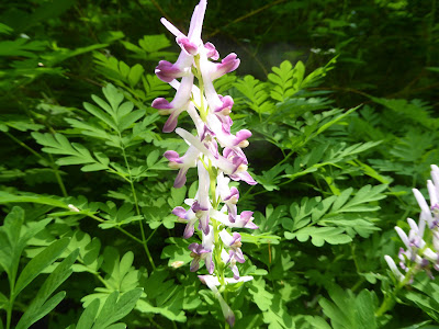
Wild flowers


Love the moss on the rocks.


The Great Depression struck in 1929, and timber, Oregon’s most important industry, tanked. The whole state, and Silver Falls along with it, was devastated. One program, the Civilian Conservation Corps, put young unemployed men to work constructing buildings, trails, bridges, retaining walls, and other park infrastructure - most of which are on the National Register of Historic Places. Most of the buildings are still standing and in use. They even had WIFI at the Lodge CafĂ© just a mile walk from our campsite.
 
South Falls from the bridge

Lower South Falls


The peaceful sound of Silver Falls was a treat. Every morning just before sunrise, which is quite early this time of year, the birds would sing and chatter for a half hour. There was plenty of time to read while sitting under the trees without TV or internet at our campsite to distract us. A campfire in the evenings was a good end to a darn good day.
 
Heading to Wine Country in McMinnville, OR.

Monday, May 21, 2018

Oregon's Covered Bridges

So many places to ride

Cottage Grove

The Covered Bridges Scenic Bikeway with six covered bridges and a path along the Row River needed to be explored. We had considered staying in this small town before settling 20 miles north in Eugene for our home base. Next time we pass this way, we will be sure to make a longer stop here.
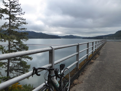
The Row River Trail comes complete with a dam, a lake, a river and two covered bridges to investigate for 16 miles that runs from Cottage Grove, Oregon, up the Row River, climbs to Dorena Dam, and runs along the shores of Dorena Lake. The mornings start with cloudy skies that usually clear in the afternoons. We like to get going in the mornings, which are chilly, but left very few people on the trails.
 The rails to trail follows the route of the former Oregon Pacific & Eastern Railroad line which made for nice easy riding with the 3-4% grade. This was good for my tired legs after riding the steep rolling hills of the vineyards a few days earlier.
Mike had some trailer repair work to do on our "rest" day. A small leak under the hot water heater was getting worse. Things are pretty compact in there and he was having trouble getting to the source of the leak. I got out my flashlight and suggested he knock out the lower section of wall under the sink. I soon heard pounding and crashing noises. He walked out with the culprit and was able to replace it. Now he is working on fixing the wall.


It is good to have my own personal bike mechanic and leak fixer along.
Dogwoods, one of the many trees in bloom.

Howard Buford Recreation Area

The recreation area next to Mt Pisgah Arboretum has 17 miles of hiking trails. We took the shortest (meaning steepest) to the top of Mt Pisgah with a 1100 foot climb in 1.5 miles but chose trails that were less steep on the way back down for a nice 4 miles. Steep down hills can be hard on the toes.
Fortunately, it was cloudy, once again, as we headed out.

Turtles along our walk along the river.

The spring flowers were out for the wildflower festival this weekend at the Mt Pisgah Arboretum.


I am not sure I know why he was pointing but went with it.

 A metal map on a pedestal at the summit that each hiker or runner touches when they reach the top.

I was wondering if two weeks in Eugene might be a bit long but found that this not so large city had plenty to keep us interested without driving too far. It was a lot of bike riding miles.

A giant salad bar down there.
 

Willamette River Trail

We left the campground on our bikes and headed towards downtown to find the river trail. A wide paved path runs along both sides of the river with several bridges for bikes and pedestrians to cross the river through several lovely parks.
We came across this electric derby race going on outside of the high school. The engineering students make their derby cars and race them. They had transponders that count their laps. The winner is the person with the most laps in one hour.

I took us 13 miles, a few u-turns and a couple of helpful people to find the Saturday Farmer's Market. We were getting hungry and found some excellent empanadas and a cookie before heading back home. Well, after Mike went back and got two cookies for the road.

The people of Eugene have been quite welcoming and helpful when we were lost. It was a pleasure to visit.

One last picture from the rose garden in the park where we were supposed to make a left at to get to downtown according to a very nice person on the trail.
 
On to Silver Falls.


Sunday, May 13, 2018

On to Eugene

Moving into the Willamette Valley

Oregon is known for its wildlife, and elk are some of the most majestic and interesting animals in the state. The Dean Creek Elk Viewing Area's 1040 acres, located several miles east of Reedsport Oregon.
 
The herd of 60 to 100 Roosevelt elk roams freely in the protected pasture, woodland, and wetland areas, sharing their habitat with other wildlife including bald eagles, Canada geese, beaver, and black-tailed deer. A fence separates them from the roadway.
As we drove past the area, we were in luck.


We came to cycle parts of the 132 miles Willamette Bikeway through one of the most productive and beautiful agricultural valleys in the world and known for pinot noir wine, hops for brewing beer, hazelnuts and marionberries. We made Armitage County Park, that happens to have WIFI and internet, our base.
 

Coburg

 
We checked the weather which said that the rain from the previous day should be clearing out of the area in that later part of the morning. Once the sky started clearing, we headed out to see that the bikeway had to offer.
 
 
We rode through the cute town of Coburg just two miles from our campground and continued north. We could see the rain to the west of us and hoped it was moving west. A few more miles ahead, we saw another sheet of rain in the north. They both seemed to be heading towards us. Turning around seemed prudent even though we were loving the ride through the farm country. It was a little too late and we got drenched. Our shoes felt like lakes and not an inch of us was dry when we got back. The mud track up our backs wasn't so pretty either. No picture, we just wanted to be dry.
 
The campground having great new washers and dryers was greatly appreciated. Our bike shoes dried out in a couple of days and we were ready to go again.
 

Brownsville 


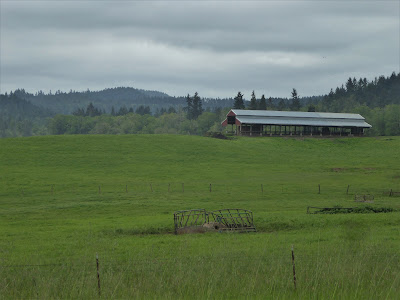
As we rode through farm land, we would ride into small towns with old buildings and plenty of history.
 

Thomas Mill State Park

Thompson's Mills is a unique survivor of times past, chronicling 160 years of Oregon rural life and  the owners who adapted the mill to the changing world around it.  It is the last water-powered mill in the state and its turbines can be seen in action on guided tours. A water right that predates statehood produces the water flow that still runs the milling machines for demonstrations.
Oregon has this great state park along the bikeway. We stopped in for an excellent tour with demonstrations.
 
Riding our bikes every other day seems to be a good balance for us. On our cycling days off, we find interesting places to visit and sights to see after doing the shopping and laundry. Sometimes, we skip the laundry and shopping.
 

 Oakridge and Westfir

We had to see what was in the mountains east of town.
 Lowell covered bridge on Lookout Point Reservoir on our way to Oakridge.
Oakridge in the mountains east of Eugene is known as the "Mountain Biking Capital of the Northwest" and was decorated with bikes along its streets.

Hot springs in the national forest are a favorite place for us to visit. Along Salt Creek, 8 miles east of Oakridge is McCradie Day Use that has a trail to the river and hot springs.  There are also springs across the creek if the one closest to the road is too full of people. The creek was running too high to walk across. But a bridge 1 mile east crosses the creek to another set of hot springs where the naked people happened to be today. We waved and they waved back.

Office Covered Bridge in Westfir is the longest in the state with a walkway. The water in  North Fork River was crystal clear.

After our picnic lunch in the covered bridge day use area we took a hike along the North Fork Trail.

So many trails, so little time.


Cuenca, Ecuador

An Expat Destination The morning after returning to Quito we boarded an hour-long flight to Cuenca. Driving up the winding roads would have ...