We wanted to do some hiking in the north mountains of Georgia. Mike looked on Passport America's site and found a cute campground by Lake Chatuge. It was celebrating its reopening and would have been half price ($17.00) even without PA this week. The Appalachian Trail is less than 10 miles away and other trails nearby.
I was glad that the drive was only 100 miles and Mike could handle that alone. The winding road along the Ocoee River without a shoulder would have made us both tense. Him from worrying about my driving and me due to his worrying.
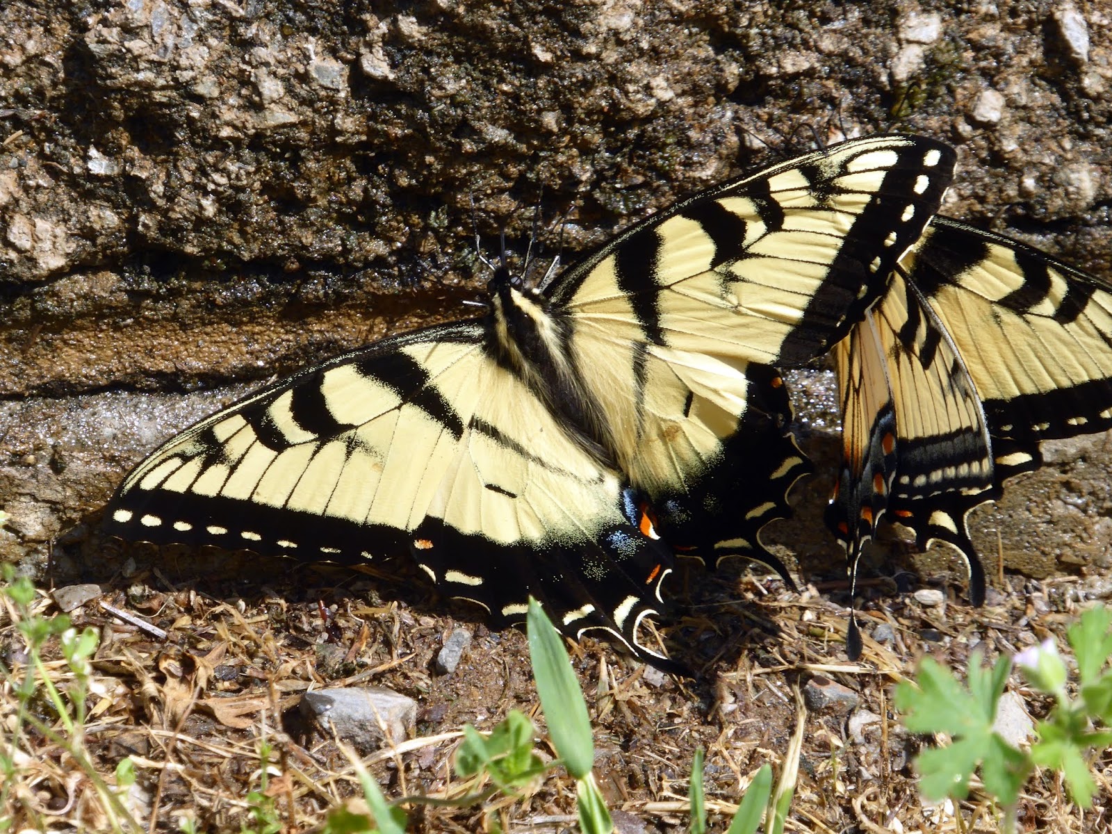
We made several stops along the river and came upon a Georgia State Butterfly (Tiger Swallowtail) hatch. There were so many flying all around us as we walked.

Ocoee River

Another beautiful stop was at the site of the1996 Olympics whitewater kayaking park with plenty of hiking trails to keep a person busy for quite sometime.

The TVA runs the dams to provide electricity to the community. They have scheduled water releases for the kayakers and rafters. A portion of their fees are returned to the TVA for compensation of the loss of energy they would have generated.


Fire lookout

Hiawassee, GA

Our great site on the hill.
Who knew it would be reopening weekend? Music in the barn and hot dogs, hamburgers and soda for the guests and people from town.

To read about the interesting history of this campground click here.
B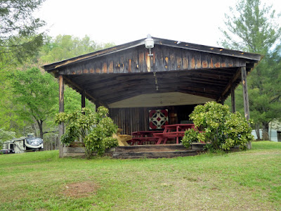
The Music Barn

They plan to have Saturday concerts this summer.

Reopening Ribbon Cutting

Some Bluegrass with fun story telling

Barbershop quartet


We drove to Dick's Creek Gap for our day hike which was steep up one mile down, a half then back up and so on for 5 miles. We ran into quite a few through hikers and those out for sections. One couple, starting in North Carolina, were trying to get 17 miles in for the day to make it to Springer by the end of the week.


We were told that many people find this part of the AT pretty tough because of all of the ups and downs. One lady said her knees were giving her a hard time. 70 miles with that big pack could be wearing on knees.

In the evening back at our campground, a community campfire was lit as the sun went down. Several people staying at Mountain View Campground gathered around to visit and look at the stars. We learned about the Star Walk app that we downloaded on our smartphone from the owner of the campground Damien. We point it at the sky and it tells us the stars, planets and constellations we are looking at

For the next day's hike, we chose High Shoals Falls. Thank goodness for smart phones. We found what we thought was the trailhead. According to the phone, there would be a green markers to show us the way to the right since there was also a trail to the left. Shortly down the hill, there was a sign to tell us this was the right way.


As we walked along the lush trail, there were many different very small flowers lining the path. At times, the mountain laurel had fallen on the trail making it look like a wedding had just happened.


After our hike to High Shoals Falls, we headed over to Brasstown Bald, the highest point in Georgia and just down the road from our hike.


Brasstown Bald, GA, rising 4,784 feet above sea level, is Georgia’s tallest mountain. Its incredible 360 degree view allows we to see Georgia, North Carolina, Tennessee and South Carolina on a clear day.

The north Georgia Mountains turned out to be a real treasure. The people have a real sense of community. As the days came to an end, we weren't sure we were ready to pack up but were so glad that we found ourselves here.


