Saturday, April 16, 2016

Leaving Yosemite and Vasquez Rocks

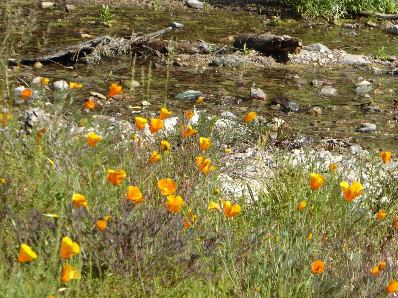
The rain started last night and was so nice to listen to. California is getting some much needed moisture and the wildflowers are showing up.


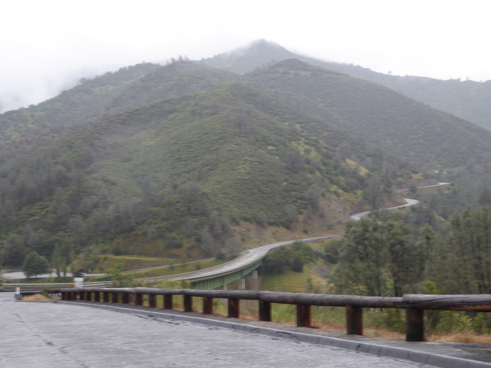
We took the twisty road back down.

Then we took another one up which was more narrow than the last with one more back down.


In Coulterville the coffee shop lady suggested that we take the scenic route. That was not a good plan due to more of the ugly roads. We had checked with the person at the RV park desk before we left and he thought this was fine. Not so much.... They said "It is only 20 miles to Mariposa".

Coulterville was named after George Coulter, one of the first whites to come to the gold camp already populated by Chinese and Mexicans.


  Highway 120 winds through rolling hills dappled with heritage oaks, past picturesque small towns including Groveland where Gold Rush history was made, and on into the dramatic high country with  views of the majestic Sierra Nevada.

Our morning visitor after another night of rain.
 
We stopped in Santa Clarita for a couple of days in a Thousand Trails resort and felt there had to be something interesting here. There was a brown sign along the road side that said Vasquez Rocks so we had to check it out.
The famous Vasquez Rocks has been used as a film site for Star Trek (Captain Kirk battling the Gorn), Blazing Saddles, The Flintstones and many others. The Pacific Crest Trail runs right through the park, and that there is a rich history that includes ancient Native American petroglyphs.
And westerns
 
 
In the canyon, you’ll see holes in the canyon walls with bird markings. There are owls that nest in there.
 

  Vasquez Rocks is named after notorious bandit Tiburcio Vásquez, America's most infamous Hispanic bandit who used the rocky region to elude capture from California law enforcement in 1873 and 1874.


The PCT runs through the Rocks.

Poison Oak and its cousin the Poodle dog brush are a couple of elements to be dealt with on this section of the Pacific Crest Trail. This part of the trail is definitely a winter endeavor for those intrepid thru hikers. The sun became pretty uncomfortable just the short time we were out there.

Some interesting pictographs


Thursday, April 14, 2016

Yosemite


Our previous visit to Yosemite was in the fall and  not even a drop of water from the waterfalls. This was not the case this time. The snowpack is high and water sheds at almost normal made for quite a show.
Yosemite National Park is set within California’s Sierra Nevada mountains. It’s famed for its giant, ancient sequoias, and for Tunnel View, the iconic vista of towering Bridalveil Fall and the granite cliffs of El Capitan and Half Dome.

The road to Glacier Point is closed until May because of all of the snow they have received this year. We were able to drive easily through the Park due to early season but the handy shuttle was making its rounds.  
 

Waterfalls of all sizes could be seen in every direction.


We stayed in a quiet campground 5 miles from the entrance to the campground instead of in the park. We thought it would have been nice to stay in the park with easier access to the hiking trails but found where we were was just right. The campground in the village area was pretty crowded with families. Is it still spring break? 


Vernal falls in the distance.

Our slow going 4 mile hike got steep at times but downhill was good.


There are also many bike and walking trails throughout the Park.

Vernal Falls before we climbed up to it. The mist was pretty strong making the trail slick.

After our hike, I had to get some forms signed online and used the internet at the village while we had lunch. A couple of fellows from Australia joined us at our table. They had lots of stories about their travels.

Yosemite falls


Tuesday, April 12, 2016

Modesto, CA and Labcorps

I don't start working in Oceanside, CA for 2 more weeks and we decided to spend some time in Yosemite. I didn't take the job in WA because they switched shifts on me and passed on Monterey, as much as I wanted to stay, there was no place to stay with less than an hour drive. The company usually provides the housing if I don't find a good RV park. I couldn't even find a bad one and CCTC wasn't up for finding an apartment on this contract. As we were leaving Monterey, the nurse manager from Oceanside called and made an offer for the job there if I would like. We liked. 

There is a time factor when accepting a contract and knew I would have to get a drug screen and TB test before going into the National Park. Stacey found a Labcorp in Modesto on our way (kind of) to Yosemite and faxed over the order so we could stop in. We arrived at noon but Labcorp does drug screens at 1pm and would have to wait until 3 for the blood draw for TB.  We headed over to the library to print some forms and got groceries to fill the time. Then off to Yosemite, finally.
These had to be the windiest 8 miles of road we have ever driven and were pretty relieved when we got to our campsite. Backseat driving can be exhausting.

The drive was only 190 miles but we were pretty well done from finding our way around Modesto and decided to have a down day the next day. Mike started the day with a great breakfast.

We watched the ducks fly up and down the Tuolumne River next to our camp site and read our books. 


 Creek side dining with a fire and wine at the chef's table with the chef. 

Monday, April 11, 2016

Pinnacles National Park- Old Pinnacles Trail to Balconies Cave Loop


We would have started our hike earlier but had to drive a couple of miles out of the park and sit along the roadside to get a Verizon signal to make phone calls for my job. A deputy stopped by when she saw us sitting in the pullout and asked if we needed help. We told her no just a Verizon signal. She chuckled. We were on the trail shortly after 9:00 am.

The wild flowers along Chalone Creek.

A couple that we met earlier asked us about the trail we were coming down and then told us about this trail. The first 1.5 miles were rolling along the creek before a little bit of a climb.


There are many different ways to get out and camp. A lady next to us who is in her 70s slept in her SUV in a sleeping bag, had her stove and everything she needed. She would read and look for birds or stay up at night looking at the stars. She seemed very happy.  Nothing is going to stop her.


 The temps in the cave felt so good since this was a pretty hot day for a 5.5 mile hike. Fortunately, there was quite a bit of shade along the creek. 
 

We didn't have to crawl through the Balcony Caves but had to scramble up the walls.

Longer legs would be handy about now.


There are bats in this cave.


Our flashlight was the only way to see the waterfall behind the rocks.  It was difficult to hold the flashlight and use our hands to pull up at the same time so we would take turns climbing while the other person shined their light.

Yep, we walked under these bad boys and didn't have to bend over.


That was our trail down there.

Balconies Cliffs Trail across from Machete Ridge

Grey pinecone.

At the end of the day, we were watching the turkey vultures circling and then the lens people came out. You know, the people with the big binoculars and cameras. They seemed to know something I didn't. We went to investigate and they showed us the Condors soaring with the vultures and explained the difference. We listened to the regular turkeys making noise as the sun went down.
 
A darn good day.

Cuenca, Ecuador

An Expat Destination The morning after returning to Quito we boarded an hour-long flight to Cuenca. Driving up the winding roads would have ...